Why Town Edges Grow in Patches, Not Rings
Why town edges grow in patches, not rings: learn how roads, older clusters and open parcels shape uneven growth, and how to read the pattern.
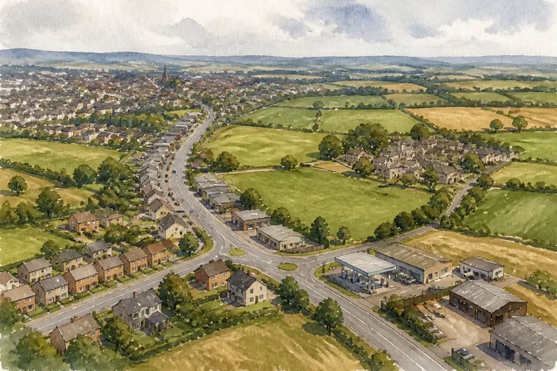
On the bus out of town, the last row of houses may give way to fields, then a petrol station, another pocket of homes and a strip of workshops. That broken sequence is a familiar sign of why town edges grow in patches, not rings: development follows particular routes, inherited clusters and parcels of land rather than spreading evenly in every direction.
A neat circle on a map is a useful abstraction, but a town is made from decisions attached to specific places. A road junction may attract shops while a nearby slope remains open; an older hamlet may sit apart from the main centre; a large parcel may be easier to develop than several smaller ones. To read an uneven edge, it helps to compare the forces that make separate patches with the choices that can connect them.
Why does a town edge form in patches?
Urban growth is selective. A settlement usually expands where movement, land ownership, services and planning rules make building possible or attractive. Those conditions vary from one side of town to another, so the urban edge can advance along a corridor, pause, and reappear around a separate cluster.
“Town edge” here means the changing boundary between the built-up settlement and more open land. It is not necessarily a line on the ground. A road, a line of houses and a field may overlap as parts of the same edge, while the boundary on a planning map may be drawn for a different purpose.
Three forces often make the patchwork visible:
- Routes: Roads connect places, but their junctions, bends and access points shape where new uses can locate.
- Older clusters: Hamlets, farm groups and village streets can remain distinct even as the town grows towards them.
- Open parcels: The size, ownership and permitted use of land can leave gaps beside newly built areas or enable a separate pocket of development.
These forces interact. A road alone does not create a continuous strip of building, and an open parcel does not automatically become a development site. The pattern is best understood by asking what makes each patch possible and what keeps the spaces between it and the town open.
What does a road-led edge look like?
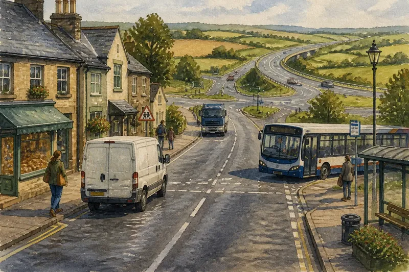
Road-led growth gathers along a route that carries people and goods between the town and elsewhere. A main road can attract workshops, shops, storage yards or housing because it offers access and visibility. At a junction, several routes meet, and the place may become a focus for services that would not fit naturally in a quiet residential street.
This pattern can look like a ribbon: development stretches outward along both sides of a road while land behind it remains open. It can also appear as a series of separate nodes, with a shop or business site near one junction and homes farther along. The spaces between buildings are not necessarily signs of failed growth; they may reflect field boundaries, access constraints or different land uses.
Road-led growth suits uses that depend on direct vehicle access, passing trade or links to other settlements. It can also make sense for people who need to travel regularly beyond town. Its limitations are equally concrete: a road may be noisy or difficult to cross, and buildings strung along it can leave nearby homes and services poorly connected on foot.
When reading this kind of edge, distinguish the route’s role from the land beside it. A busy road may pass through open land without generating development, while a quieter junction can anchor a compact cluster. Access to the carriageway, the surrounding street network and the permitted uses all matter.
How do older clusters shape later growth?
Many towns have smaller settlements at their margins: a village, a group of farm buildings, a former crossroads or a row of houses that existed before the main town reached it. These places bring their own street pattern and local centre, so expansion may approach them without absorbing them into a single continuous neighbourhood.
Where a historic lane meets newer streets, the change may be visible in building spacing, plot shape or the direction of roads. The older cluster may retain a compact core while newer development forms a separate patch beyond a field or along another route. On a map, the town can therefore appear to have several centres rather than one solid edge.
This pattern can suit residents who value a smaller local centre or a distinct neighbourhood identity. It can also preserve useful services close to homes. But if the old cluster and the expanding town are connected only by a narrow road, the gap may make everyday journeys awkward. A map can show proximity without showing whether a comfortable walking route exists.
Imagine a town with a small village east of its main centre, separated by pasture and linked by a narrow lane. If a new housing area is built beside the village rather than beside the centre, the visible result may be a larger village cluster with open land still between it and town. That expected pattern would follow the location of the new development, not a uniform outward ring.
How do open parcels interrupt the built edge?
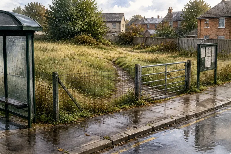
Open land is often divided into parcels: identifiable pieces with their own boundaries, access and ownership. A parcel may remain undeveloped because it is used for farming, reserved for another purpose, difficult to reach or subject to planning constraints. Meanwhile, a neighbouring parcel may be built on. The result is a notch, gap or detached patch in the edge.
Parcel shape matters as much as its area. A long, narrow piece beside a road may be suited to a different use from a broad plot behind existing homes. Several small holdings can require more coordination than one continuous parcel. Conversely, a single large holding can make a separate development area possible without connecting to the town’s existing streets.
This is why the phrase “empty land” can mislead. The apparent gap may be actively used, planned for a future purpose or kept open by a decision that has nothing to do with the pace of nearby building. To understand the pattern, look for boundaries, access points and the way the parcel meets both built and open land.
For people who want a clear transition from town to countryside, a broad open parcel can maintain that distinction. For residents seeking connected streets and nearby services, a gap may be less convenient if it forces a long detour. Which outcome matters more depends on the local purpose of the land and the routes around it.
Which pattern should you look for first?
There is no single best pattern for every settlement. A road-led corridor can support movement and access; an older cluster can keep a local centre legible; parcels left open can preserve land uses or mark a deliberate boundary. The useful question is which pattern explains the place you are examining, and whether its connections serve the people who use it.
How can I tell whether a road is driving growth?
Look for buildings and activity concentrated near junctions, along a main route or at points with direct access. Then check whether streets behind the frontage connect into the town or remain separate.
Why can a village remain distinct beside a town?
Its original street pattern, local services and open land around it can preserve a separate centre even as development draws closer. A gap on the map may reflect a boundary or land use rather than distance alone.
What does a gap between built-up areas mean?
It may be a working parcel, a planned open space, land with limited access or simply a piece that has not been developed. Identify its boundaries and surrounding routes before deciding that it is an accidental leftover.
How do I choose which edge pattern matters most?
Start with the purpose of your decision: access, neighbourhood identity, open land or the relationship between homes and services. Compare the actual routes and land uses on the ground, then ask which pattern supports that purpose without creating a disconnected pocket.
How can you read an uneven edge on a map?
Begin with a current street map and trace the continuous built-up streets rather than assuming that every nearby building belongs to the same urban area. Mark the main roads, junctions and separate clusters. Then compare those with an aerial image or a local land-use map, which can reveal open parcels and boundaries that street labels leave out.
Keep the observations separate at first: where buildings are concentrated, where routes run, and where open land remains. This helps avoid a common mistake—treating the road, the settlement boundary and the edge of a particular land use as though they were the same line. A planning map may define a settlement boundary for policy, but that line need not match the visible arrangement of buildings.
On the ground, note how people can move between patches. A short gap may be crossed by a footpath, while a seemingly close cluster could be cut off by a fast road or a lack of crossings. The shape of the edge is not only what appears from above; it also includes the routes that make neighbouring places feel connected or separate.
For example, say you are considering where a new community facility might serve both a town and a nearby village. If the map shows a road-led strip between them but no comfortable walking connection, a site beside the route may look central yet remain hard to reach on foot. Comparing the street map with the actual crossings could point instead towards a location near an existing connected junction.
What makes a patchwork edge work well?
A patchwork is not automatically disorderly. Separate clusters can have clear roles and remain connected by streets, paths and services. Open land can retain a distinct function, while compact development around an older centre can support local activity. The question is whether the pieces relate to one another or merely sit side by side.
When comparing options for a place, use a few grounded questions:
- Access: Can people reach each cluster by more than a single difficult route?
- Connection: Do streets and paths link the patches, or do roads and fenced boundaries divide them?
- Purpose: Is open land serving a visible use or local plan, rather than being treated as vacant by default?
- Scale: Does a new pocket relate sensibly to the nearest centre, or create a detached destination?
- Daily needs: Can residents reach shops, services and public transport without every trip requiring a car?
These questions help distinguish an intentional mosaic from a collection of disconnected pieces. They do not imply that every open gap should be built on or every new building should extend an existing street. The right choice depends on local land uses, access and planning decisions; where those decisions affect a property or proposed development, check the relevant local plan and consult an appropriately qualified planning professional.
Why town edges grow in patches, not rings becomes clearer once each patch is read as the result of its own route, cluster or parcel. The practical lesson is to look for the connections between them as carefully as the buildings themselves. A boundary that seems irregular from above may still form a coherent place on the ground, if its separate parts have clear purposes and usable links.