Field Boundary or Roadside Verge: Two Kinds of Open Edge
Field boundary or roadside verge: learn to distinguish the land division from the road-side strip by tracing its line, structure and practical role.
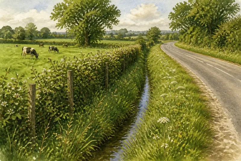
You follow a hedge beside a pasture, then reach a grassy strip between the hedge and a lane. The hedge and the grass may look like one edge, but they can serve different purposes. To tell a field boundary from a roadside verge, trace where each line runs and ask what it separates or supports.
What makes a field boundary different?
A field boundary marks a division between parcels or land uses. It may be a hedge, stone wall, fence, drainage ditch, bank or a combination of these. Its defining clue is the land on either side: it separates fields, pasture, gardens or other holdings, whether or not a sign marks the division.
Boundaries can also shelter livestock, provide habitat or manage water. These functions may overlap. A ditch, for instance, can carry runoff while also marking a division, so consider its form and the surrounding land rather than assuming that every feature has only one job.
What does a roadside verge do?
A roadside verge is the strip beside a road, often between the carriageway and a boundary, path, ditch or adjoining land. It forms part of the road corridor in practical terms and may provide space for visibility, drainage, signs, utilities or maintenance access. Grass and wildflowers can make it look like natural open ground, but its position alongside the road is a useful clue.
Some verges are narrow and closely cut near junctions; others widen beside rural lanes and include trees, ditches or a footpath. A verge can sit beside a field boundary without being the boundary itself. For example, a fence may divide pasture from the roadside strip, while the grass between the fence and tarmac follows the road.
How can you read a field boundary or roadside verge?
Observe the same stretch from a public path or another permitted place. Record the line, structure and visible signs of maintenance. The aim is to describe what the edge appears to separate or serve, not to infer ownership from its appearance.
- Trace its line: If the feature separates two fields or land uses, describe it as a possible boundary; if it follows the road, describe it as a possible verge. If both patterns appear, record both lines separately.
- Note the structure: If you see a hedge, wall or fence between different land uses, treat it as a boundary clue; if you see a grass strip beside the carriageway, treat it as a verge clue. If a ditch or bank is present, note it as a separate feature that may serve more than one role.
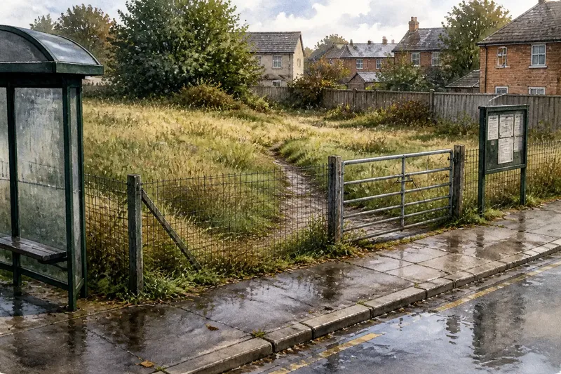
- Look for entrances and changes in land use: If a gate opens from the road into a field, note where the access point meets the boundary; if the feature continues along the carriageway, note its road-side alignment. If the pattern is unclear, leave the classification open rather than guessing.
- Observe water only from a safe permitted place: If a channel appears to carry runoff beside the road, record a possible drainage role; if it also lies between land uses, record both clues. If you cannot see its course safely, do not approach or enter it.
- Notice maintenance clues: If grass is cut around a sign or sightline, record a possible road-management purpose; if a hedge or fence continues along a field edge, record a boundary clue. If maintenance does not clarify the role, rely on the line and surrounding land instead.
- Check access signs and route information: If signs or an official path map indicate a permitted route, stay within it; if access is unclear or restricted, do not enter the strip. If you need a definitive access or ownership answer, consult the relevant authority or a qualified professional.
Say you walk a public footpath beside a pasture and reach a narrow grassy strip between the hedge and a lane. The hedge continues along the pasture, while the strip follows the road and contains a drainage channel. You can describe the hedge as the field-boundary clue and the grass as the verge clue, while noting that the channel may contribute to both land management and roadside drainage. That description keeps the visible roles distinct without claiming to establish ownership.
Which clues help, and which can mislead?
Continuity is useful: a boundary may follow the edge of a parcel across a bend or continue beyond a road frontage, while a verge tends to track the road. But a field boundary can run parallel to a verge, leaving two adjacent lines. Gates, field entrances and changes in land use can help you tell them apart, but they do not prove ownership.
Plants are clues to management, not legal status. A diverse hedge on a bank may be a substantial field edge; a closely cut grass strip may be maintained for road visibility. Neither appearance alone establishes who owns the ground or who may use it. Maps, signs and access information can help with context, but a property or boundary question may require title information and professional advice.
Why can an edge look different in another season?
Leaf cover can hide a fence or ditch, mowing can open up a verge, and crops can obscure the wider shape of a field boundary. A single visit may therefore leave some details unclear. Note what is visible and what has recently been cut, planted or concealed, then compare the underlying line if you pass again.
Stay on permitted routes rather than stepping into crops, roadside vegetation or watercourses for a better view. If seasonal growth makes the distinction uncertain, describe the visible features and leave the classification tentative.
Can a map or sign identify a field boundary or roadside verge?
Does a map show whether a strip is a verge?
Maps can show roads, paths, watercourses and field patterns, helping you understand the setting. They may not show the precise division between a verge and adjoining land, so compare the map with visible features without treating either as definitive proof.
Does a fence prove where the legal boundary lies?
A fence is a physical clue, not a definitive statement about ownership. For a property decision or boundary dispute, check the relevant title information and consult a qualified professional rather than relying on a walk or map alone.
Is roadside grass public open space?
Not simply because it is green or unfenced. Roadside strips may be managed for transport needs and may not be intended for general access, so follow signs and use only permitted routes.
Why might a ditch run between a road and a field?
It may carry surface water, mark a division or serve both purposes. Observe its course from a safe, permitted place and describe the visible relationship without assuming its role from appearance alone.
How should you describe the edge?
Use specific wording such as “hedged field boundary beside a roadside verge” rather than calling the whole strip spare land or assigning it to one parcel. This distinction recognises that adjacent features can have separate roles: dividing land, carrying water, accommodating a route or supporting road management. When you describe a field boundary or roadside verge, naming the visible line and its setting is more useful than guessing at ownership.