From Turnpike to Bypass: How Roads Change Their Role
Learn how a road shifts from settlement street to bypass, and how to read the changing links between junctions, services and nearby places.
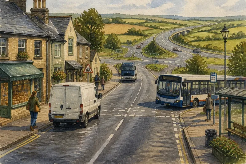
A delivery van stops outside a village shop as a bus signals to turn. Beyond the last houses, the same road meets a bypass and fields open on either side. To understand how roads connect settlements and shape their edges, follow how their jobs change: who they serve, what they carry and where they lead.
How did an old road serve the settlement?
Before a bypass exists, a main road may be both a route between places and the settlement’s everyday street. Residents use it to reach shops, schools, bus stops and side roads; travellers use it to pass through. These purposes can overlap, which is why a road’s local role is often visible in the buildings and entrances beside it.
Older roads may follow a valley, skirt a steep slope or cross a river at a practical point. Junctions and crossings can help explain where a settlement grew. Notice whether shopfronts face the road, or whether homes sit behind drives and hedges: these details suggest how people access the street and relate to it.
Imagine an invented village where the main road passes a school, bakery and bus stop. A resident walks to the shop while a lorry travels between towns. If a later bypass carries some longer journeys elsewhere, the expected observable result is less through-traffic past those buildings, while the old road still connects residents to local services.
What changes as a road takes on a faster role?
Through-traffic means vehicles travelling through a place towards a destination beyond it. As travel patterns change, a road may be adapted to carry such traffic more directly. Turning vehicles, parked cars, pedestrians and long-distance journeys can then compete for room, particularly where the road also serves homes and businesses.
Road alterations may straighten bends, strengthen surfaces or change junctions. A route made easier to follow at speed can alter how nearby buildings and land relate to it; crossing on foot, for instance, may feel less direct. The effect depends on the design, crossings and surrounding uses, not just the road’s label.
Signs can identify a main route, but a road may still provide access to farms, housing and local destinations. To understand its role, look at where vehicles can enter and leave, how side roads connect, and whether buildings face the route or turn away from it.
Why do settlements build bypasses?
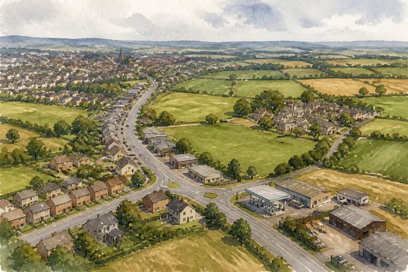
A bypass is designed to carry some through-traffic around a built-up area rather than along its central street. It can separate longer-distance movement from local access, but it does not remove every journey from the old road. The original route may simply become more focused on local connections.
The bypass creates a new edge, often meeting older roads at junctions or roundabouts. It may be easy to cross by car but inconvenient on foot, depending on the layout. Its junctions can influence how the settlement relates to nearby farmland, workplaces and other destinations.
A bypass redistributes movement. Some journeys may shift to the new route, while others still need the old one. Land near junctions may attract uses that depend on vehicle access, such as storage or roadside services, but whether those uses appear depends on planning decisions and local circumstances.
How can you read the old road’s new role?
Once a bypass offers another way through, the former main road may remain a shopping street, serve homes and businesses, or link neighbourhoods. Its local role may stay strong where buses, schools or shops depend on it. Look at how the street works now rather than assuming its earlier function has vanished.
Imagine an invented market town where a Saturday market remains beside the former through-road after a bypass opens. The town keeps the market entrance on the old street, while signs direct longer-distance traffic to the bypass. The expected observable result is that visitors can reach the market and nearby shops locally, while journeys past the settlement have another route; the trade-off is that the old street still needs to accommodate market access and ordinary traffic.
Parking, crossings, pavements and junctions can affect how practical local access feels. Changes to them depend on decisions by the relevant authorities and on the needs of people using the street.
How can you tell what a road connects now?
Compare the road’s access points, junctions and surroundings. A route serving longer journeys may have fewer direct entrances and more controlled junctions. A local street often has frequent driveways, crossings, bus stops or side roads. Many roads do both jobs, so treat each clue as part of the picture rather than a fixed classification.
- Trace its destinations. If it links settlements directly, then consider a through-route role; if it leads mainly to nearby homes and services, then consider a local-access role instead.
- Check junction spacing. If connections cluster at a few larger junctions, then note a more controlled route; if side roads meet it frequently, then allow for more local movement.
- Look for entrances. If buildings have direct driveways onto the road, then record immediate property access; if they use separate access roads, then note that movement is channelled elsewhere.
- Notice everyday stops. If bus stops, crossings, shops or school gates are present, then account for local journeys; if they are absent, then check nearby streets before concluding that local access is limited.
- Compare both sides. If the road links homes to fields, workplaces or neighbouring districts, then note those connections; if it blocks a direct crossing, then record the barrier and look for the nearest alternative route.
- Compare old road and bypass. If the old road reaches the centre and the bypass offers a direct path past it, then distinguish local access from through-movement; if both serve the same destinations, then describe their shared role rather than treating them as opposites.
What do people ask about bypasses and old roads?
Does a bypass always make the old road quiet?
No. Buses, deliveries, shoppers and residents may keep using it, and some through-traffic may still need to pass through. The road’s role can shift without every journey disappearing.
Is a bypass the same as a ring road?
Not necessarily. A bypass routes traffic around a settlement or built-up area, while a ring road forms a route around or through the edge of a larger urban area. Their layouts can overlap, so inspect their actual connections rather than relying on the name.
Why might businesses locate near bypass junctions?
Junctions can offer convenient vehicle access and visibility to travellers. That may suit some businesses, though land-use decisions, access arrangements and local demand also influence what develops.
Can the old road still connect a town to the countryside?
Yes. It may remain the direct route to farms, villages, walking paths or local services after some longer journeys move elsewhere. Its usefulness depends on which side roads and crossings remain connected.
What does a road’s changing role reveal at the edge?
Follow the road in both directions and note where its connections change. A bypass may carry traffic around the town, while the older route leads into its centre. The junctions between them show how people reach homes, work, services and open land—and where the road makes those journeys harder.
For the search phrase how roads connect settlements, the useful question is not only which route is more direct. Ask who can reach each destination from each road, and where the routes meet. That distinction helps explain how a road can cease to be the main street for through-traffic yet remain an important link within the settlement.