A First Walk Along the Town-Country Edge
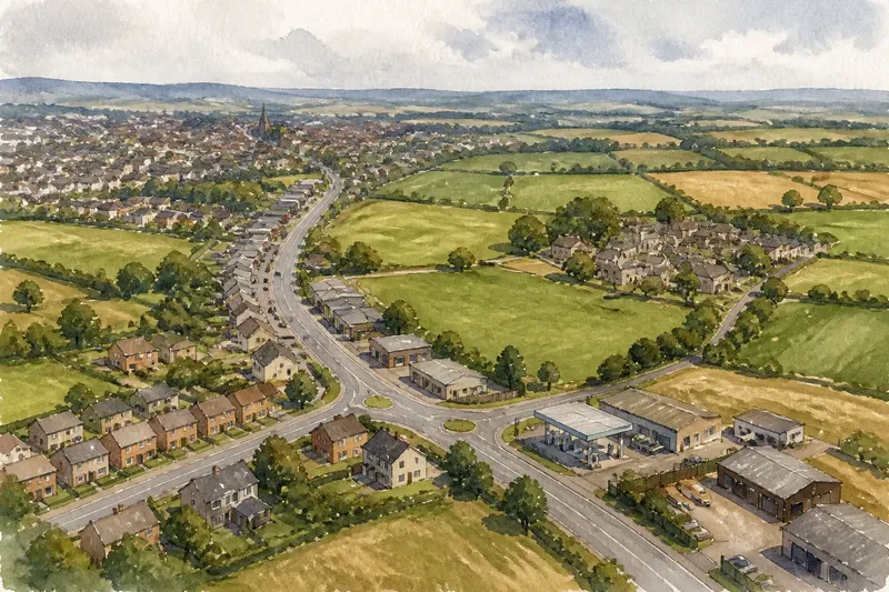
A first walk along the town-country edge shows how street names, local landmarks and changing routes describe the transition between settlement and countryside.
You leave the last row of shops and reach a sign for Mill Lane, though no mill stands nearby. On a first walk along the town-country edge, names like this can preserve older routes, fields and meeting places even as the surroundings change. Read them as clues to how people describe the transition, not as proof of what the land was or who owns it.
How can place names guide a first walk?
Place names help organise what you see. A road, stream, farm, estate or public green may carry a name shared with nearby streets, linking parts of the settlement that otherwise seem separate. Before setting out, consult an Ordnance Survey map or a council map and note a few names along a public route from built-up streets towards open land.
Look at how names appear on signs as well as maps. A street sign may use a shortened form, while a map labels the same route with a different name or spelling. Record the wording and where you encountered it; that lets you compare the mapped name with the name used locally without assuming one is more correct.
What can street and field names tell you?
Some names refer to visible features: Brookside may sit near a stream, and Green Lane may run beside open ground. Others recall a person, former building, farm or local activity that is no longer apparent. A name can outlast the feature it once described, so treat it as a prompt for further attention rather than a direct account of the present landscape.
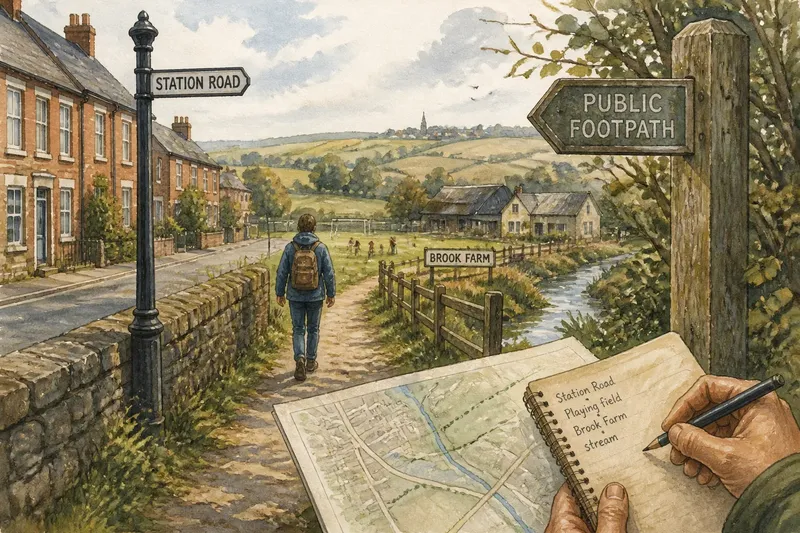
As you walk, note the sequence of names alongside the sequence of spaces. A route might pass from Station Road to Orchard Close, then meet a lane named for a nearby farm. The change in names can suggest how the town’s streets connect to an older rural network, while the buildings and ground show what that connection looks like now.
Imagine you start at the library on Station Road and follow a signed public footpath towards Brook Farm, using a paper map. You write down each name at its sign, then note that the path leaves a terrace-lined street, skirts a playing field and reaches a stream. The result is a useful route description linking names to visible transitions; it does not establish when the names originated or how the land is used beyond your viewpoint.
How should you record names without overclaiming?
Keep a compact field note with three details: the name exactly as displayed, its location on the route and the feature you can see nearby. Separate direct observation from interpretation. “Mill Lane sign beside a row of houses” is an observation; “this must have been the mill road” is a guess unless supported by reliable local history.
- Check whether the name appears on both the street sign and your map; if the forms match, record the shared spelling, and if they differ, preserve both versions.
- Check whether a named stream or green is visible from the public route; if it is, note the direction and nearby landmark, and if it is not, record the name without implying the feature is present.
- Check whether a farm name appears on a public sign or map; if it does, use it as a route reference, and if it does not, avoid assigning that name to an unmarked building.
- Check whether a footpath is signed or shown as a public route; if it is, follow the marked line, and if its status is unclear, turn back or consult local rights-of-way information.
- Check whether a name changes at a junction; if it does, note where the change occurs, and if there is no sign, avoid inventing a boundary between named sections.
- Check whether your photograph includes private space or identifiable passers-by; if it does, leave it out or frame the sign alone, and if it does not, keep it as a visual reminder of the location.
Where can you check a name’s history?
A map is useful for location, but it rarely explains a name’s origin by itself. For local context, look for a parish history, a local studies collection at the library, an archive catalogue or a council heritage resource. Older maps can show whether a name appeared in an earlier form, while local histories may explain a farm, landmark or route. Treat explanations as claims to compare, especially where sources disagree.
Place-name elements can offer a broad clue, but spelling and meaning shift over time. A name containing “ford”, for instance, may suggest a crossing, yet the modern route could have moved and the crossing may no longer be visible. Confirm the location from maps and local records before drawing a historical conclusion.
What should you look for on a first walk?
Should I follow every named lane?
No. Follow a clear public route and use lane names as orientation, not permission to enter private land. If a lane is marked private or access is uncertain, stay on the signed route and check local rights-of-way information.
What if a map and street sign use different names?
Write down both forms and the places where they appear. The difference may reflect a shortened sign, a map label or a local variation, so do not silently replace one with the other.
Can a place name prove what used to be there?
No. A name may preserve an older feature, but it can also have another origin or survive after the landscape changes. Use local histories, archives and older maps to check a proposed explanation.
How do I use names to describe the town-country edge?
Pair each name with a visible change, such as a street becoming a signed footpath or houses giving way to open ground. This records how the route and its names relate without claiming that a single sign marks the settlement’s exact edge.
How can you turn notes into a clear route description?
Arrange names in walking order and add a plain description of what changes between them. For example: “From Station Road, the signed path passes the playing field, reaches Brook Farm and crosses the stream.” Keep the wording tied to what you saw, and identify any historical interpretation separately as something to verify.
A first walk along the town-country edge becomes more legible when names are treated as part of the route rather than as decorative labels. One last useful check is to compare your notes with a map after returning: if a name cannot be placed confidently, mark it as uncertain instead of forcing it into the landscape.