How to Record a Vacant Parcel Without Assuming What It Is
Record a vacant parcel’s visible features and neighbours clearly, while keeping ownership, public access and possible future uses separate from observation.
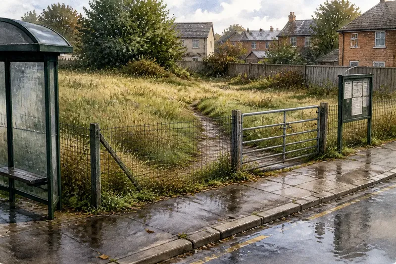
At the bus stop, a patch of rough grass sits behind a low fence, with a muddy line leading towards the pavement. Those details make a useful record of a vacant parcel; they do not tell you who owns it, whether anyone may enter, or what might happen there.
Vacant parcel notes are most useful when they distinguish the scene from the story someone might attach to it. Record surfaces, edges, connections and signs as observable facts, then mark unanswered questions plainly. This keeps a description useful to neighbours or planners without turning an assumption into a claim.
What should vacant parcel notes record?
A parcel is a piece of land treated as a unit in a map or property record. Its boundary may not be obvious on the ground. A hedge, ditch, fence or change in mowing can indicate a division, but does not necessarily establish the legal line.
Describe the parts you can see: rough grass, gravel, bare soil, scrub, standing water, a locked gate or a worn strip. Locate each feature in relation to something recognisable, such as the bus shelter, rear wall or road junction. If the edge is uncertain, say so rather than drawing a confident outline around the whole site.
Keep three kinds of information distinct:
- Observation: what is visible or audible at the time, such as a gravel strip beside the eastern fence.
- Source information: what a sign, map or public document says, with its location and date noted.
- Interpretation: what the arrangement might mean, clearly marked as uncertain when evidence is incomplete.
How can you separate vacant parcel notes from assumptions?
Use direct descriptions before suggesting an explanation. “Flattened grass runs from the gate towards the pavement” describes a visible line. “People use this as a shortcut” identifies users and purpose that may not be known.
Apply the same care to ownership and future use. A tidy verge does not prove that a council maintains the parcel; a planning notice does not mean the work has happened. If you cannot confirm a detail from a suitable source, record it as unknown rather than filling the gap with a plausible story.
Say you are standing on a public pavement beside a hypothetical vacant parcel after rain. You note rough grass behind a wire fence, a shallow puddle at the kerb, and a flattened line ending at a closed gate. You check a noticeboard visible from the pavement and see no notice there. Your record can say exactly that, adding that ownership, the status of the route and any proposal remain unknown; it should not call the line a public path or the parcel neglected.
What does an edge reveal, and what does it leave uncertain?
Describe each side separately, including what lies beyond it. A parcel might meet a garden fence, a car park, a drainage ditch and a pavement on different edges. Naming those relationships is more informative than saying only that the site is “beside housing”.
Edges can affect movement and visibility without settling access rights. A low hedge may allow a view through while discouraging entry; a fence gap may make it physically possible to cross. Neither feature, by itself, establishes permission or a public right of way. Note barriers, gates, signs and the route’s visible endpoints, but check appropriate local information before making a claim about access.
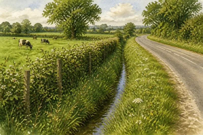
Likewise, a ditch may appear to carry water, but a single visit cannot establish its full drainage role. Record where damp ground or water is visible and when you saw it. Treat explanations about who maintains a feature or where a pipe leads as questions unless reliable information answers them.
How do you record routes, water and shared features?
A vacant parcel may connect to its surroundings through more than a path. After rain, you might see puddles, leaf deposits, damp soil or a small channel. A worn line may point towards a lane, while a drain cover or utility marker indicates visible infrastructure nearby. These details describe present relationships; they do not reveal the full history or function of what lies below ground.
Include the conditions that shape what you see. Note whether grass is tall or recently cut, whether leaves obscure a track, and whether a puddle appeared after rain. Shade and sound also vary: a tree may shade one corner at the time of observation, while traffic noise is more noticeable beside the road. Avoid presenting a momentary condition as permanent.
Use a simple sketch if it helps. Mark visible features and nearby landmarks; draw a parcel boundary only when its extent is clear, otherwise label the outline “approximate” or leave it out. An arrow for apparent water movement should be marked as an observation, not a drainage survey.
What should you check before describing a vacant parcel?
How can I describe a boundary that is hard to see?
Use nearby features to locate the scene, such as “rough grass between the lane and rear fence”. If the fence’s relationship to the parcel is unclear, state that the boundary is uncertain rather than treating the fence as proof of ownership or extent.
Does a gap in a fence mean the public can enter?
No: a gap shows only that passage may be physically possible. Record its location and any signs or barriers, then consult suitable local access information before describing the route as public.
How should I record a sign or planning notice?
Note where it is, when you saw it and what it says, separating that source information from the current physical scene. A notice describes information or a proposal, not necessarily a completed change.
What if the parcel looks unused but has no sign?
Describe the visible condition, such as rough grass or an unoccupied structure, rather than labelling the land unused. The absence of a sign in the places you can see does not establish ownership, maintenance arrangements or future plans.
Which details belong in a field-note checklist?
For each item, record the observation and let the result guide what you say next. If a detail is not visible, mark it unknown instead of substituting a guess.
- Position: Check which public viewpoint or permitted location you used; if the viewpoint is identifiable, name it, otherwise state that the position is approximate and avoid precise location claims.
- Surface: Check whether the ground is grass, gravel, mud, paving or mixed; if the material is visible, name it, otherwise describe only the visible cover and leave the underlying surface unknown.
- Edge: Check for a fence, hedge, ditch, kerb or mowing change; if the feature is clear, describe it and what lies beyond, otherwise say the edge is unclear and do not present it as a boundary.
- Route: Check for a worn line, gate, path connection or barrier; if a track is visible, state its direction and endpoints, otherwise do not infer a route, and in either case avoid claiming public access without suitable information.
- Water: Check for puddles, damp ground, channels or leaf deposits; if present, record their location and conditions, otherwise say none were visible at that visit rather than asserting that drainage is absent.
- Signs and sources: Check for notices or markers from your lawful viewpoint; if one is legible, record its wording or a faithful summary, location and observation date, otherwise report only that none was seen from that viewpoint.
- Unknowns: Check whether ownership, maintenance, access rights or future use has been verified; if not, mark each relevant point unknown, and if it matters to a decision, consult an appropriate local record or qualified professional.
Respect privacy and access while making notes. Stay on public routes or land where you have permission, and avoid photographing people or looking into homes. If a gate is locked or a sign indicates restricted entry, record what is visible from outside rather than crossing the boundary.
How can vacant parcel notes support later discussion?
Careful vacant parcel notes give later conversations a clearer starting point: a ditch beside the road, a worn line ending at a gate, or scrub that meets a garden fence. They do not decide what should happen to the land, but they help people distinguish the present scene from claims about ownership, access or a proposed change.
Before sharing a record, retain its observation date and viewpoint, and keep source information separate from your own description. That small habit makes it easier for someone else to understand what you actually saw—and to decide which unanswered questions need checking.